Jessica Cejnar Andrews / Tuesday, Sept. 3, 2024 @ 3:51 p.m. / Environment, Fire, Oregon
Curry County Commissioners Say New Wildfire Hazard Map Puts Undue Risk Onus On Private Owners, Ignores Public Agencies
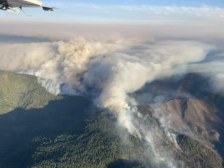
The Flat Fire started on July 15, 2023 southeast of Agness, Oregon in Curry County. | Photo courtesy of InciWeb
Curry County commissioner Jay Trost on Thursday called on his colleagues to declare a state of emergency in response to a draft wildfire hazard map Oregon is expected to roll out in October.
Trost argued that the new map, which is being developed through Oregon State University, the Oregon Department of Forestry and the Oregon State Fire Marshal, makes private property owners responsible for managing the wildfire risk on their lands. Public entities, he said, “have zero consequence for managing their lands appropriately.”
And, though OSU states the map isn’t intended to be used to adjust insurance rates, Trost called for a meeting with local agents.
“We [give] them the opportunity to explain to the public why some of them are not writing policies for our county and why some of them are,” he said. “And for the ones who are, allow the public to know who they are so they don’t default on their mortgages because they cannot fulfill their insurance requirements due to the mortgage lenders.”
The new map will impact residents wanting to build new structures or renovate existing ones, Trost said.
“You can have no flammable surfaces on your infrastructure except for on your timber framing,” he told his colleagues. “Your siding now all has to be Hardie Board and your roofs all have to be metal. There are all kinds of different building parameters when this is codified mid next month which will be in effect going forward.”
Trost had attended a gathering of county commissioners from around the state last Monday. Organized by the Association of Oregon Counties, the meeting provided an opportunity for commissioners to raise concerns about the draft wildfire hazard map with forestry department and OSU representatives.
According to Trost, representatives from nearly every county around the state participated with the exception of Lane, Multnomah and Clackamas. He noted that on the draft wildfire hazard map, those counties are considered low risk.
“We were allowed to comment on the map,” Trost told his colleagues. “Not the subsequent building and planing procedures that are associated with the risk areas nor the pending insurance situations that may occur from it. We were only allowed to comment on the map.”
Trost said he was concerned that the marine layer that blankets Curry County isn’t considered a risk mitigator. He said he also asked if requiring the state and federal government to conduct fuel suppression projects and better manage timber resources would reduce the risk.
“The [U.S.] Department of Forestry was present in the meeting and so was the BLM,” he said. “And they declined to comment.”
Required by Senate Bill 762, the wildfire hazard map is meant to guide state resources to communities most at risk for wildfire. Trost pointed out that the orange on the map signifies the areas at high risk, while the purple areas are considered moderate risk.
He pointed out that much of the southern portion of Curry County is considered high risk. Other mitigating factors, Trost said wasn’t taken into consideration when OSU and state forestry officials created the map was fire history and wind patterns.
Most of the time, he said, Curry County’s wind moves from west to east from off the ocean — unless there’s a Chetco Effect.
Trost also pointed out a purple area in the center of the county, which signifies where the Chetco Bar Fire burned in 2017.
“I said it is obvious you have identified some recent fire history, but if you have looked at historic fire history, there has not been a wild land fire that has impacted our coastal communities in over 100 years,” Trost said.
Though he acknowledged that the map isn’t meant to be used to adjust insurance rates, Trost said that multiple insurance companies aren’t writing new insurance policies or renewing existing ones for Curry County residents. He said he heard of one resident whose home insurance policy had increased $7,000 for the year.
Trost’s colleague, Commissioner Brad Alcorn, who lives in Brookings, said he, too, received a letter from his insurance provider informing him that his policy would be cancelled.
“They said it was due to the wildfire risk and they gave me a score — I don’t remember what it was, but it was pretty clear this map would have been used to come up with that,” Alcorn said.
Alcorn said his home is in a residential neighborhood about 150 yards from the water, “well within the marine layer,” and the Brookings Fire Department is about a mile and a half away.
Alcorn urged his colleagues to combine their voices with city officials, including the mayors, because it’s not just affecting those who live in the rural area.
“Because we haven’t been able to harvest our timber appropriately, now the people of this county have to pay more for their insurance and to build and to plan,” he said. “If we would have been allowed to harvest that timber, then we wouldn’t have had to go to the people and ask them for a levy like we just did. This makes no sense at all. We are being governed by people who don’t live here.”
This is Oregon’s second attempt at creating a wildfire hazard map. The first map, released in 2022, received such intense public backlash that the state rescinded it, Oregon Public Broadcasting reported in July.
Public comment ended on Aug. 18. When the map is finalized in October, the state’s Building Code Division will work on creating new building codes and the Oregon State Fire Marshal will start creating new rules for defensible space, OPB reported.
CLICK TO MANAGE