Jessica Cejnar / Monday, Aug. 24, 2020 @ 11:11 a.m. / Weather
Del Norte Interior, Upper Smith River, Lower-Middle Klamath Areas Included in Red Flag Warning
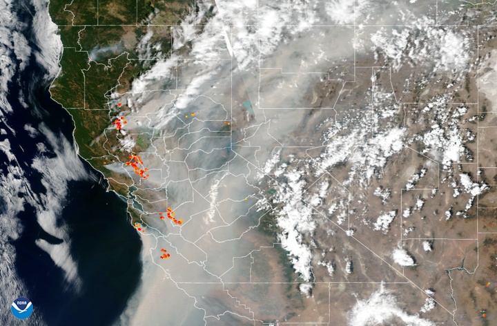
This NOAA satellite image shows smoke from wildfires in California last Wednesday. Photo courtesy of NOAA.
Weather forecasters are warning that scattered thunderstorms and gusty winds are creating dangerous conditions in Del Norte's interior.
From the National Weather Service:
A moist and unstable mid-level airmass will continue to spread north across the region today. Isolated to scattered thunderstorm development remains possible across much of Northwest California through this evening. Lightning combined with dry fuels will increase the threat for fire starts.
CAZ201>204-211-212-264-276-277-283-250030-
/O.CON.KEKA.FW.W.0008.000000T0000Z-200825T0600Z/
North Coast-Coastal Mendocino-Upper Smith-Lower Middle Klamath-Hoopa-Van Duzen/Mad River-
Lake County Portion of Lake/Napa/Sonoma RU-Interior Mendocino-W Mendocino NF/E Mendocino Unit-Trinity-
1043 AM PDT Mon Aug 24 2020
...RED FLAG WARNING REMAINS IN EFFECT UNTIL 11 PM PDT THIS
EVENING...
* AFFECTED AREA...Fire weather zones 201, 202, 203, 204, 211,
212, 264, 276, 277, and 283.
* THUNDERSTORMS...Scattered thunderstorms will pose a threat for fire starts due to lightning.
* OUTFLOW WINDS...Gusty thunderstorm winds will cause ongoing fires to behave erratically.
* IMPACTS...Any fires that develop will likely spread rapidly. Outdoor burning is not recommended.
PRECAUTIONARY/PREPAREDNESS ACTIONS...
A Red Flag Warning means that critical fire weather conditions are either occurring now, or will shortly. A combination of dry fuels, lightning strikes, and gusty thunderstorm winds can contribute to extreme fire behavior.
CLICK TO MANAGE